Camino Francés: Walking 780 km From Saint-Jean-Pied-de-Port to Santiago
A stage-by-stage Camino Francés itinerary from Saint-Jean-Pied-de-Port to Santiago: the Pyrenees, Pamplona, the meseta, León and Galicia in about 5 weeks.
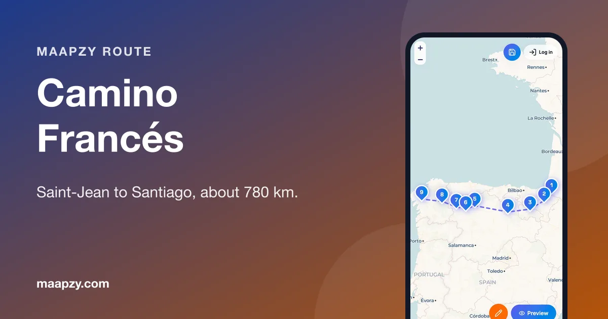
The Camino Francés is the route most people mean when they say "the Camino". It crosses four regions of Spain, three great cathedral cities and the empty high plains of Castile before climbing into green Galicia. It's also the easiest Camino to organise: waymarking is excellent, and you'll find a bed, a café and other pilgrims every few kilometres. New to planning? Start with our guide to planning the Camino.
The route at a glance
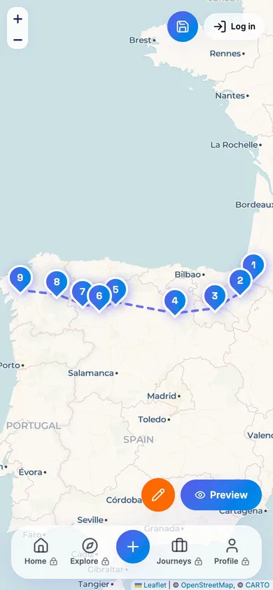
- Days 1–3: Saint-Jean-Pied-de-Port to Pamplona — over the Pyrenees (about 68 km)
- Days 4–12: Pamplona to Burgos — Navarre and La Rioja wine country (about 210 km)
- Days 13–20: Burgos to León — the meseta (about 180 km)
- Days 21–28: León to Sarria — Astorga, the mountains and into Galicia (about 200 km)
- Days 29–33: Sarria to Santiago — the final 115 km
Days 1–3: Over the Pyrenees to Pamplona
The first day is the hardest: about 25 km from Saint-Jean-Pied-de-Port to Roncesvalles, with roughly 1,250 m of climbing. The high Route Napoléon is closed from 1 November to 31 March for safety, so in winter take the lower Valcarlos road instead. Many people break the climb with a night at Orisson, but beds there go months ahead.
From Roncesvalles the path drops through beech woods and Basque villages to Pamplona, home of the San Fermín festival (6–14 July). If you're walking in early July, book early or plan around it.
Days 4–12: Pamplona to Burgos
Leaving Pamplona you climb the Alto del Perdón, with its line of iron pilgrim sculptures, then walk through Puente la Reina and its Romanesque bridge, and Estella. Just past Estella, the Irache winery has a fountain that pours free wine for pilgrims.
Logroño, capital of La Rioja, is the place for a night of tapas on Calle Laurel. The route continues past vineyards to Santo Domingo de la Calzada, where a live hen and rooster live inside the cathedral, then over the Montes de Oca to Burgos, with its Gothic cathedral, a UNESCO World Heritage Site. Take a rest day here.
Days 13–20: The meseta to León
Between Burgos and León lies the meseta, a high plateau of wheat fields and very big skies. Some people skip it by bus; many end up saying it was their favourite part. It's flat and quiet, and it's where your mind finally slows down. Start early in summer, as there's little shade, and carry extra water between villages.
Look out for the ruins of the San Antón convent, the hilltop castle at Castrojeriz and the Templar church in Villalcázar de Sirga. León rewards a rest day: its cathedral has some of the finest medieval stained glass in Europe.
Days 21–28: León to Sarria
Astorga has a cathedral and a bishop's palace designed by Gaudí, and is famous for chocolate. Beyond it, the path climbs to the Cruz de Ferro, an iron cross on a mound of stones where pilgrims leave a stone they've carried from home. The descent to Ponferrada, with its Templar castle, is steep and stony, so take it slowly.
After the vineyards of El Bierzo comes the last big climb, to O Cebreiro, a stone village at about 1,300 m where you enter Galicia. From here, concrete markers count down the kilometres to Santiago.
Days 29–33: Sarria to Santiago
Sarria is the most popular starting point because it's just over 100 km from Santiago, so the path gets much busier. Remember to collect two stamps a day from here. Our day-by-day guide to the last 100 km covers Portomarín, Melide, Arzúa and the walk into Santiago.
Where to sleep and what it costs
The Francés has the densest network of albergues of any route, so outside July and August you can usually walk until you're tired and find a bed. As a rough guide for 2026, budget €40–€60 a day with dorm beds and pilgrim menus, or €80–€130 with private rooms. Book ahead in summer and for Orisson, Pamplona during San Fermín and every night from Sarria.
When to go and how to get there
May, June, September and early October offer the best mix of weather and space. July and August are hot on the meseta and crowded in Galicia; winter is quiet but many albergues close. To reach Saint-Jean-Pied-de-Port, take a train via Bayonne in France, or a bus or taxi from Pamplona. Santiago has an airport and fast trains to Madrid. Compare options with Maapzy's travel booking.
Make it your own
- Short on time? Walk Burgos to León, or León to Santiago (about 310 km, two weeks).
- Want it quieter? Try the Camino del Norte along the coast.
- Extend it with 3–4 days to Fisterra and Muxía on the Atlantic.
- Walking alone? Our solo travel guide for beginners helps, though on the Francés you'll rarely walk alone for long.
Camino Francés at a glance
- Days 1–3: Saint-Jean to Pamplona over the Pyrenees
- Days 4–12: Puente la Reina, Logroño, Santo Domingo, Burgos
- Days 13–20: the meseta, Castrojeriz, León
- Days 21–28: Astorga, Cruz de Ferro, Ponferrada, O Cebreiro
- Days 29–33: Sarria to Santiago, two stamps a day
- Take rest days in Burgos and León
- Use the Valcarlos route from November to March
- Map your stages in the planner
Frequently asked questions
How long is the Camino Francés?
About 780 km from Saint-Jean-Pied-de-Port to Santiago de Compostela, usually walked in 30–35 days.
Is the Camino Francés hard?
The first day over the Pyrenees and the climb to O Cebreiro are tough, but most of the route is moderate. The main challenge is walking day after day, so build up your fitness and look after your feet.
Can I skip the meseta?
Yes, buses and trains link Burgos and León. But many pilgrims find the quiet meseta days the most memorable part of the walk.
When is the Route Napoléon closed?
From 1 November to 31 March. In that period, walkers should use the lower Valcarlos route to Roncesvalles.
Sources
Start your next trip on a map.
Pin a few cities and see what a realistic route looks like — in five minutes, for free.
Open the plannerKeep reading
- How to Plan the Camino de Santiago: Routes, Stages, Budget and PackingPlan your Camino de Santiago step by step: choose a route, set your daily stages, get the credential and Compostela, budget for 2026 and pack under 8 kg.
- Walking the Last 100 km of the Camino: Sarria to Santiago in 5 DaysWalk the last 100 km of the Camino Francés from Sarria to Santiago in 5 days: stages, distances, where to sleep, the two-stamp rule and getting to Sarria.
- Camino Portugués From Porto: A 12-Day Walk to SantiagoA 12-day Camino Portugués itinerary from Porto to Santiago via Barcelos, Ponte de Lima, Tui and Pontevedra, plus the coastal route and Spiritual Variant.